|

MAPS FOR CELL & SMARTPHONES
Back
to Main GPS Maps Page
For Windows Mobile, Symbian & Android based Cell Phones
Our cell & Smarthphone map series are available
for Mexico as well as other latin American countries., has been developed thinking in the
traveler, tourist, adventurer or explorer who would like to have a reliable and
handy map suitable to be used in their cell phone without excessive roaming
charges when traveling, as all the information needed is stored in the device.
They are also fully functional where no cell phone coverage is available. The
Navitel Navigation System offers a wide function selection and characteristics
in a friendly, easy to use interface and is compatible with the most used cell
phone operating systems such as Symbian, Windoews Mobile and Android. An iPhone
compatible version will soon be released as well.
ABOUT NAVITEL

- Pocket PC navigation program developed in Russia and
widely used in Europe
- Interfase available in several languages including text
and voice prompts in English
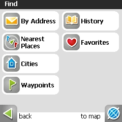
- Search functions: by address, points of interest, cities
and user waypoints
- Navigation guiding to all the features mentioned
- Exchange current position in
real time with other Navitel users via SMS text messages
- Option to generate and save tracklogs
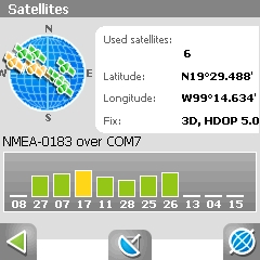
- GPS Satellite signal status screen
- Easy to install in devices using Pocket PC 2003,
Pocket PC 2003 SE, Windows Mobile 5 and 6 with touch screen
- North up, Track Up or Route Up screen settings during
navigation
- Navigation Information Panel
- Street oneway indicator
- Instruments Panel with several travel parameters
- Various zoom levels
- Route creation
- Day and night screen modes
- Without access fees to maps or
satellites
- Free lifetime upgrades
COMPATIBILITY
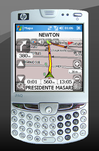
WINDOWS MOBILE
PDA (Personal Digital Assistant), Pocket PC or
Smartphones with Pocket PC 2003, Pocket PC 2003 SE, Windows Mobile 5/6 operating
system equipped devices with touch screen, From 1 to 10 Mb of RAM,
Support of NMEA-0183, SIRF Binary
and Garmin protocols. Esternal receivers can be connected through a serial
port, USB, BlueTooth, Compact Flash, SDIO. Memory Card with 244 Mb available for the map files.
Download
Navitel for Windows Mobile
Instructions
SYMBIAN
Devices with Symbian operating system with or
without touch
screen such as Nokia 5800, Nokia X6
& Nokia N97
and more.
It is possible that it may work in other similar devices.
Download Navitel for Symbian
devices
Instructions
ANDROID
Devices with Android operating system such
as Motorola Droid & Milestone. Supports versions 1.5, 1.6, 2.0 and
2.1.
Download
Navitel for Android
Instructions
To verify tour device's
compatibility with Navitel, you may download and install the version that
matches with your device and test it tin demo mode. In this mode, there are
certain limitations, such as only 100 Kb size maps may be seen, but it will
allow to confirm the compatibility with your device before purchasing. Please
contact us should you need support.
In all cases, an internet connection is required (3G, GPRS, Wi-Fi)
for Navitel and map activation.
AVAILABLE MAPS
MEXICO GPS ATLAS 2010
MAP FEATURES
- Full highways coverage
with over 620,000 Km (321,000 miles) of roads all over the country
- Street detail for more than 3400 cities
- Auto routing and navigation feature in highways, streets,
unpaved roads, double and single tracks
- Comprenhensive urban Points of Interest data base such
as restaurants, shopping centers, gas stations, banks, hospitals, government
buildings and more
- Reference to over 280,000
rural locations
- Address search with house number in
major cities.
- Over 70,000 urban Points of Interest data base such as
restaurants, shopping centers, gas stations, banks, hospitals, government
buildings, and more in cities such as Mexico City, Guadalajara, Monterrey,
Veracruz, Cancun and the Mayan Riviera, Merida, Puerto Vallarta,
Villahermosa, San Carlos and others
- Trailer and Motor Home Parks in Mexico
- Extensive, over 45,000 points of interest including
geographical features such as beaches, mountains, lakes, dams, rivers and so
forth
- More than 2000 gas stations along the Mexican Highways
Network
- International and state boundaries, lakes, rivers and
national parks.
- Contours at 50 meter (164 ft) interval for the
Baja Peninsula and 100 meter (328 ft) interval for the remainder of the
country
|
Navitel + México GPS
Atlas 2010 Package $ 62.00 USD
Currently unavailable.
|
|
Mexico GPS Atlas 2010 (If you
already have Navitel, the map may be purchased alone) $ 45.00
USD
Currently unavailable.
|
NOTE: Upon placing your order, your
map will be
delivered within 24 to 48 hours, Monday through Friday. Orders received on
weekends will be processed next Monday. By entering your order, you are
accepting our Terms & Conditions
Argentina
Very detailed map of Argentina with all the
major important cities such as Buenos Aires, Córdoba, Mendoza and many more.
Navitel + Argentina GPS
Atlas 2010 package $ 62.00 USD
Currently unavailable.
Argentina GPS Atlas 2010 (If you
already have Navitel, the map may be purchased alone) $ 45.00
USD
Currently unavailable.
NOTE: Upon placing your order, your
map will be
delivered within 24 to 48 hours, Monday through Friday. Orders received on
weekends will be processed next Monday. By entering your order, you are
accepting our Terms & Conditions
IMAGES
 |
 |
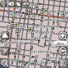
| Monterrey |
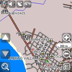
Puerto
Vallarta |
 |
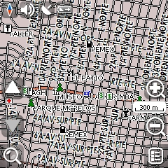 |
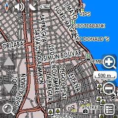
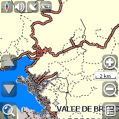
| Veracruz |
Tuxtla
Gutiérrez |
 |
 |
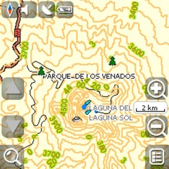
| Contours |
Unpaved roads
and trails |
 |
 |
| Satellite
Signal Strength |
Find Options |
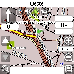
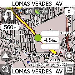
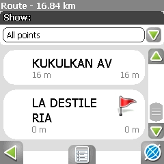
NAVIGATION
USER'S MANUAL
Download the
User's Manual
TERMS AND CONDITIONS
IMPORTANT INFORMATION
We have attempted to get the most accuracy of these maps, nevertheless due to
the information processing as well as possible inaccuracies of the raw data used,
these maps shall only be used as a reference as they are not designed for
precision navigation. They are specifically for land use and shall never be used
for sea or water navigation. We do not accept any responsibility for errors or
missing information that the maps may have.
The use of these maps is under the exclusive and unique responsibility of the
user who upon purchasing them accepts he(she) and only he(she) is responsible of
any damage that the user could suffer or provoque due to the use of this
information. Each user is unique responsible for any damage that this
information may produce to their computer and/or GPS. BiciMapas does not accept
any responsibility whatsoever in case of damage, direct or indirect,
consequential or collateral as result of the use, incorrect use or misuse of the
maps.
Your GPS receiver warranty may be affected as manufacturers do not accept nor
endorse the use of third party maps, as these ones are.
If you are not in agreement with these terms, please do not purchase nor use
this information. The action of purchasing any of our maps is understood as the
purchaser accepting the above mentioned terms.
SPECIAL NOTE REGARDING THE AUTO ROUTING FEATURE
The auto routing feature is available for
all the city streets contained in this map. Nevertheless, due to the complexity
of the urban environment, we have not yet finished integrating all the traffic
related information such as oneways, physical and regulatory turn
restrictions. We are continuously incorporating such features which will
be made available through updates. This map shall always be used as a
complement for navigation and always be aware of actual street and road
traffic.
This feature is intended to be used as navigation aid. Due to the fact that it
functions based on mathematical parameters, the calculated route may not match
with what the driver's experience or habits may consider as the best route.
Though the routing capability is available for all types of roads contained in
the map, be warned that not all oneways, left turn restrictions and other
city navigation restrictions are available.
IT IS THE DRIVER'S RESPONSIBILITY TO FOLLOW AND OBEY
ALL TRANSIT LAWS, REGULATIONS AND SIGNALS, REGARDLESS OF WHAT THE GPS MAY BE
INDICATING.
NEVER FOLLOW A GPS INDICATION THAT WOULD RESULT IN AN ILLEGAL OR DANGEROUS
MANEUVER.
The driver shall never operate the GPS device while the vehicle is in movement
and must use the support of another passenger.
The authors do not accept any responsibility whatsoever in case a user infringes
any law, regulation or signal resulting in an action from the
authorities including fines, arrest and any other, as the result of the use or
misuse of the maps.
RETURN POLICY
No returns are accepted once
the Navitel and Map Licenses have been issued. No returns are accepted on CDs.
UPDATES
All updates are for free.
The installation and/or use of this map is considered as the acceptance of
the terms exposed above. If you are not in agreement with them, DO NOT INSTALL
THIS MAP.
DELIVERY
PRICE AND LICENSING
The price payed for grants a
single non transferable license to be used in one PDA/Cell
phone device.
Pocket PC 2003,
Pocket PC 2003 SE, Windows Mobile 5 & Windows Mobile 6 are registered trade
marks of Microsoft Inc. Android is a registered trade mak of Google Inc. Symbian
is a registered trademark of Nokia
Back to GPS Maps Main Page
|